Where we work
Democratic Republic of Congo
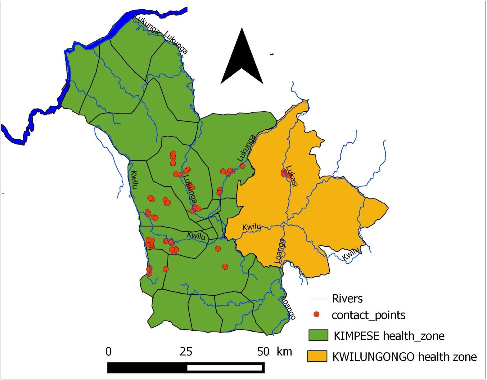
In the DRC, we work in the Kimpese Health Zone, located in the Kimpese region of Kongo Central province, 210 km southwest of Kinshasa. In contrast to the varied topography of the Ugandan study area, this region is relatively homogeneous, characterized by plateaus and rolling hills at elevations ranging from approximately 250 to 400 m. The Lukunga River and its tributaries form an extensive hydrological network, serving as essential water sources for irrigation during the rainy season. Most of the sampling locations correspond to streams derived from the Lukunga River
Uganda
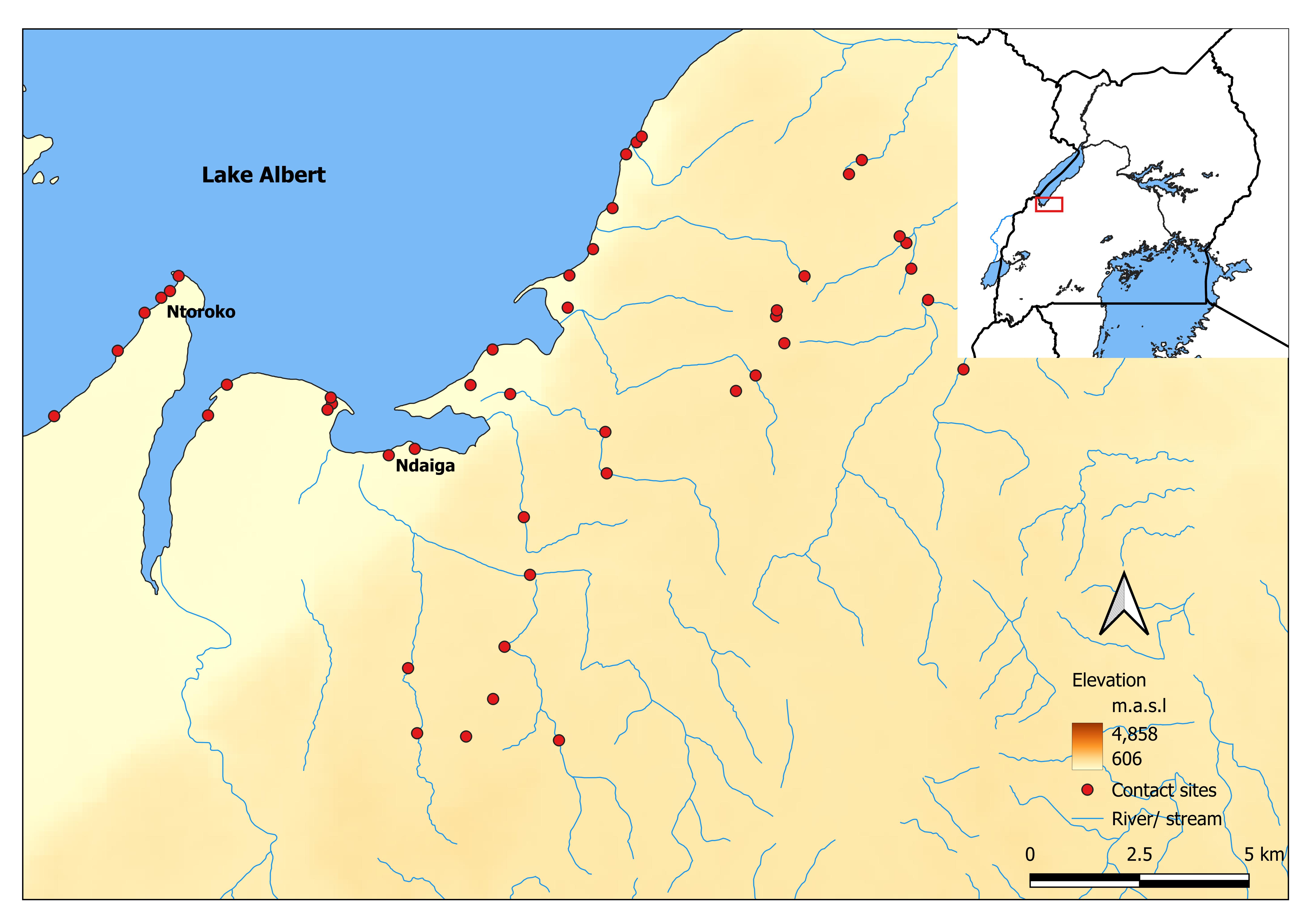
In Uganda, ATRAP operates in the southern part of Lake Albert and its surrounding upland catchments, an area spanning approximately 750 square kilometers in western Uganda. This region is home to a rich and varied hydrological landscape, including upland streams, large rivers, swamps, still water pools, spring wells, lake shorelines, and sheltered bays.
This diverse environment supports numerous human water contact activities such as fishing, washing, bathing, and water collection, many of which are directly linked to the risk of snail-borne disease transmission. Understanding where and how people interact with water sources is critical to ATRAP’s mission.